– Written by David Everard, Divisional Environmental Manager, Sappi –
It is not surprising that water and wetland issues are brought into focus during severe droughts, like the one we are experiencing at the moment. It is quite well accepted that wetlands play very important ecological and social roles in a landscape. These roles include the supply of products such as food, fuel, fibre and water and a range of cultural and ecological services such as spiritual enrichment, aesthetic experiences, recreational opportunities, educational opportunities, water purification, erosion control, regulation of climate, flood attenuation and habitat for plants and animals.
The Karkloof catchment area consists of highly productive agricultural land that is intensively utilised to produce food and fibre. The area is also very rich in wetlands and because of the intensity of land use and the importance of the area as a water catchment for the greater Durban and Pietermaritzburg area, the health and management of these wetlands is of particular importance.
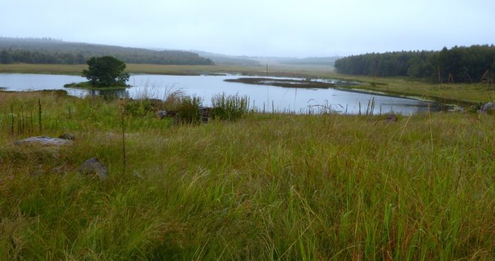
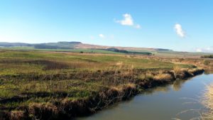
Approximately 170ha of a larger floodplain wetland at the confluence of the Karkloof, Kusane, and Mnalweni Rivers is owned and managed by Sappi. Although this area has received quite a lot of attention from a management and health point of view lately, it is interesting to look at some of the historical interventions that have occurred on these wetlands.
The 1932 aerial photographs of the area reveal that most of the greater catchment was grassland with patches of indigenous forest up against the Karkloof hills. However, there were ploughed lands on the floodplain wetlands as these were the flat fertile areas near the water and were used for growing crops. It is presumed dairy farms and other forms of agriculture developed in intensity over the next decades. In the late 1970’s the wetland areas currently owned by Sappi, were planted to Pine trees for timber production, but by the 1990’s knowledge, perceptions and practices had changed. In 1995 Sappi decided to remove the trees from the wetland floodplain and by the end of 1996 had removed 46ha, and started rehabilitating the area. In 1999 a further 10.4ha was removed, and in 2005 a full review of the area using the wetland delineation tool meant another 14ha of trees were removed.
Management of the area since 1998 has involved burning the wetland on a two year rotational basis and controlling the weeds according to a plan. There has also been some occasional grazing by cattle, although this is not a preferred option by Sappi management. The question however is, is this adequate and what can be done to further improve the functioning of this wetland?
A number of assessments have been undertaken to answer these and other questions over the last few years. In 2012 Sappi commissioned Douglas Macfarlane to do a broad assessment of all the wetlands on Sappi estates in KwaZulu-Natal with a view of identifying the most important ones from an ecosystem service point of view and prioritizing them for management. He used two main criteria for this assessment, these being the importance of the wetlands for aquatic biodiversity and for supplying goods and services. The aquatic biodiversity assessment considered data from:
- the Freshwater Ecosystem Priority Areas (FEPA’s);
- the catchment priority areas in the aquatic conservation plan for KZN; and
- the threat status of wetland vegetation groups from the national biodiversity assessment.
The goods and services he assessed were the potential of the wetlands to:
- provide flood attenuation;
- provide water quality enhancement; and
- regulate streamflow, especially in low-flow periods.
After applying a scoring system Macfarlane (2014) found that the Shafton/Kusane wetland came out as the most important wetland on Sappi land in KZN. This result led to a further three specific assessments being undertaken. In 2014 the Sappi Environmental team conducted a full “WetHealth” assessment of the area (Ndlovu 2014). WetHealth is a standardised methodology used to assess the health of wetlands. The three main criteria that are assessed are the hydrological functioning of the system, the geomorphology of the system and the vegetation. This assessment revealed that the hydrology has been impacted owing to reduced water inflows (plantations and irrigation upstream) but the health level was a B which indicates a low impact. The geomorphological score was also a B, with a small impact resulting from a number of farm dams in the immediate vicinity of the wetland. There is also a large drainage ditch entering the wetland near the polo fields. The vegetation score was also a B owing to infestations of bramble and St. Joseph’s Lily. There are also the odd poplar, wattle, pine and gum trees in and around the wetland. Overall the assessment gave the wetland a B category health score.
This year two further assessments have been undertaken. GroundTruth (Anon. 2016) as part of a larger “wetland offset” study, assessed the Shafton/Kusane wetland for rehabilitation opportunities. They identified some very old furrows that drain some of the oxbow lakes on the floodplain and proposed that de-activating these would hold and spread water across the floodplain in wet times. This proposal is extremely expensive and the costs and benefits of such action is still being debated amongst the wetland experts. The GroundTruth study also identified the weeds on the wetland as having a small impact on the vegetation health.
In a recently received assessment commissioned by WWF and conducted by Damien Walters of Ikhwane Wetland Science Walters 2016), it was found that there are about 2 ha of trees that may be too close to the hydromorphic areas of the wetland, but his recommendation is to rather concentrate management efforts on weed control in the areas that are being rehabilitated. He also emphasised the importance of buffers around the wetland to help with the purification of water carrying high nutrient loads from the surrounding intensively managed pastures and dairy farms.
In summary, therefore, the Shafton/Kusane wetland is recognised as an important wetland in the upper Umgeni catchment. It is also considered to be in fairly good health, but there are opportunities for improving the health and functioning of the wetland. On the Sappi owned portions, you can expect to see improved and ongoing weed control where the bramble and the trees (poplars, wattle, pine and gums) will be focussed upon. The burning programme will be reassessed and the wetland will be split into sections which will receive a burn every second year. This will further improve the health of this wetland which has already been shown to be on a positive trajectory with respect to its importance as habitat for aquatic and wetland associated biodiversity, and for the services it plays in the rich and beautiful Karkloof valley.
References:
- Anon., 2016. Wetland offset study and rehabilitation plan – Comrie Dam. Report No. GTW596-200516 -01. GroundTruth
- Macfarlane, D. 2012. Prioritization of wetlands on Sappi forestry estates in KwaZulu-Natal. Report No. EP52-01. EcoPulse Consulting.
- Ndlovu, H. 2014. Prioritization of wetlands on Sappi forestry estates in KwaZulu-Natal – Shafton/Kusane wetland Wet-Health assessment. Unpublished Report for Sappi Environmental Dept.
- Walters, D. 2016 Sappi – Dairy 360 wetland assessment, Karkloof KwaZulu-Natal. Unpublished report for WWF South Africa.

